Surveying or land surveying is the technique, profession, art and science of determining the terrestrial or three-dimensional positions of points and the distances and angles between them. A land surveying professional is called a land surveyor. These points are usually on the surface of the Earth, and they are often used to establish maps and boundaries for ownership, locations, such as building corners or the surface location of subsurface features, or other purposes required by government or civil law, such as property sales.
Surveyors work with elements of geometry, trigonometry, regression analysis, physics, engineering, metrology, programming languages, and the law. They use the equipment, such as total stations, robotic total stations, theodolites, GNSS receivers, retroreflectors, 3D scanners, radios, inclinometer, handheld tablets, digital levels, subsurface locators, drones, GIS, and surveying software.
Surveying has been an element in the development of the human environment since the beginning of recorded history. The planning and execution of most forms of construction require it. It is also used in transport, communications, mapping, and the definition of legal boundaries for land ownership. It is an important tool for research in many other scientific disciplines.
Techniques

Surveyors determine the position of objects by measuring angles and distances. The factors that can affect the accuracy of their observations are also measured. They then use this data to create vectors, bearings, coordinates, elevations, areas, volumes, plans and maps. Measurements are often split into horizontal and vertical components to simplify the calculation. GPS and astronomic measurements also need a measurement of a time component.
Distance measurement

Before EDM devices, distances were measured using a variety of means. These included chains with links of a known length such as Gunter's chain, or measuring tapes made of steel or invar. To measure horizontal distances, these chains or tapes were pulled taut to reduce sagging and slack. The distance had to be adjusted for heat expansion. Attempts to hold the measuring instrument level would also be made. When measuring up a slope, the surveyor might have to "break" (break chain) the measurement- use an increment less than the total length of the chain. Perambulators, or measuring wheels, were used to measure longer distances but not to a high level of accuracy. The tachometer is the science of measuring distances by measuring the angle between two ends of an object with a known size. It was sometimes used before to the invention of EDM where rough ground made chain measurement impractical.
Angle measurement
Historically, horizontal angles were measured by using a compass to provide a magnetic bearing or azimuth. Later, more precise scribed discs improved angular resolution. Mounting telescopes with reticles atop the disc allowed more precise sighting (see theodolite). Levels and calibrated circles allowed measurement of vertical angles. Verniers allowed measurement to a fraction of a degree, such as with a turn-of-the-century transit.
The plane table provided a graphical method of recording and measuring angles, which reduced the amount of mathematics required. In 1829 Francis Ronalds invented a reflecting instrument for recording angles graphically by modifying the octant.
By observing the bearing from every vertex in a figure, a surveyor can measure around the figure. The final observation will be between the two points first observed, except with a 180° difference. This is called a close. If the first and last bearings are different, this shows the error in the survey, called the angular misclose. The surveyor can use this information to prove that the work meets the expected standards.
Levelling

The simplest method for measuring height is with an altimeter using air pressure to find the height. When more precise measurements are needed, means like precise levels (also known as differential levelling) are used. When precise levelling, a series of measurements between two points are taken using an instrument and a measuring rod. Differences in height between the measurements are added and subtracted in a series to get the net difference in elevation between the two endpoints. With the Global Positioning System (GPS), elevation can be measured with satellite receivers. Usually, GPS is somewhat less accurate than traditional precise levelling, but maybe similar over long distances.
When using an optical level, the endpoint may be out of the effective range of the instrument. There may be obstructions or large changes of elevation between the endpoints. In these situations, extra setups are needed. Turning is a term used when referring to moving the level to take an elevation shot from a different location. To "turn" the level, one must first take a reading and record the elevation of the point the rod is located on. While the rod is being kept in exactly the same location, the level is moved to a new location where the rod is still visible. A reading is taken from the new location of the level and the height difference is used to find the new elevation of the level gun. This is repeated until the series of measurements is completed. The level must be horizontal to get a valid measurement. Because of this, if the horizontal crosshair of the instrument is lower than the base of the rod, the surveyor will not be able to sight the rod and get a reading. The rod can usually be raised up to 25 feet (7.6 m) high, allowing the level to be set much higher than the base of the rod.
Determining the position
The primary way of determining one's position on the earth's surface when no known positions are nearby is by astronomic observations. Observations to the sun, moon and stars could all be made using navigational techniques. Once the instrument's position and bearing to a star is determined, the bearing can be transferred to a reference point on the earth. The point can then be used as a base for further observations. Survey-accurate astronomic positions were difficult to observe and calculate and so tended to be a base off which many other measurements were made. Since the advent of the GPS system, astronomic observations are rare as GPS allows adequate positions to be determined over most of the surface of the earth.
Land surveying (also known as Cadastral Surveying)
Land surveying involves measuring and determining property boundaries. Property boundaries are the basis for all property transactions, including buying, selling, mortgaging and leasing. A secure and strong property market requires certainty in the location of property boundaries. The location of property boundaries and knowledge of matters that may affect land ownership requires specialised training.
Registered land surveyors (cadastral surveyors) are the only surveyors in NSW who are legally able to carry out boundary surveys and represent details of property boundaries on plans or prepare subdivision and certain types of lease plans.
| Land Survey |
Engineering surveying
Engineering surveyors are generally engaged in the building and civil construction industries. These surveyors undertake measurements and placemarks to ensure construction works are built by the approved design plans. They may be found working on construction sites setting out works such as buildings, roads, bridges, tunnels and various other forms of infrastructure.
Mining surveying
Mining surveyors are involved in the planning, construction and operation of various types of mines. These mines may be open cut or underground. Types of mines include coal, metalliferous and mineral sands. Each of these types of mining requires specialised input by a skilled mining surveyor. Activities of a mining surveyor can include setting out of drill patterns, excavations and conveyors, locating underground roadways and voids, taking of measurements for volume calculations, monitoring of ground movement, land management and preparing statutory mine plans. In NSW mine surveyors are registered to ensure there is a level of competence commensurate with ensuring compliance with the statutory requirements and mine safety.
Mining Surveyors Registered in NSW are the only surveyors who are legally able to carry out mining surveys and represent details of mining survey and mine workings on plans prepared for the purposes of the Work Health and Safety (Mines and Petroleum Sites) Act 2013.
| Mine Survey |
Hydrographic (Bathymetric) surveying
Hydrographic surveying involves undertaking measurements under the surface of the sea, harbours and rivers and on the adjacent shores. Their measurements are used to prepare charts of waterways and the sea for use by ships and boats to ensure a safe passage and for the design of infrastructures such as docks and jetties in ports and harbours. Using sonar scanners they can provide a picture of the sea bed without needing to get their feet wet and enabling the discovery of shipwrecks and other objects lost at sea.
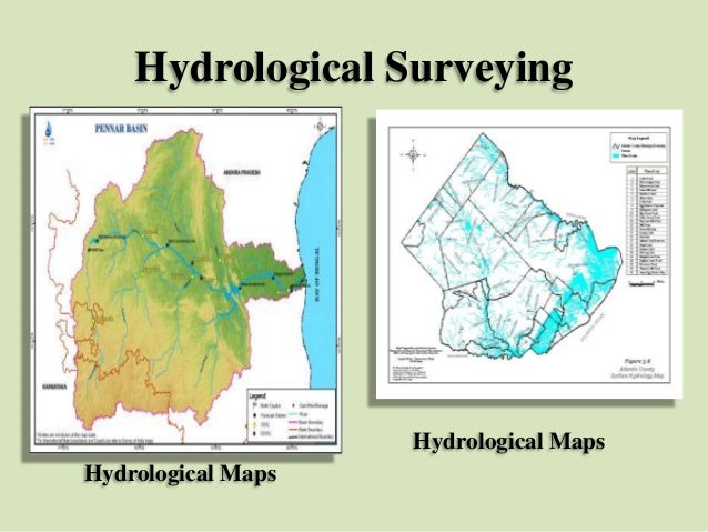 |
| Hydrological survey |
Geodetic surveying
Geodetic surveyors are involved with undertaking very precise measurements to determine the shape and size of the world and track the movement of continents. Their measurements are used in the monitoring of sea-level rise, earthquakes, and the tracking of satellites. Geodetic surveyors are involved in the development of coordinate systems and datums which are used in the production of maps and plans.
Aerial (Photogrammetry and remote sensing)
 |
| Drone Survey |
Topographic (Detail/Tachymetry)
A Detail Survey is about defining the location and heights of any number and variety of features on a site. Topographical plans can show contours along with the physical features located. This type of survey is regularly used when designing for roads, buildings, extensions and other new infrastructure. They can be carried out by all types of surveyors, however, it should be noted that only Registered Land (Cadastral) Surveyors are legally able to depict details of cadastral boundaries on detail plans.
| Topographic survey |
Notes
There are different levels of Surveyor, generally differentiated by the level of tertiary education, with some areas of surveying requiring higher levels of education and postgraduate study:
- Student of Surveying
- Assistant
- Technician
- Graduate
- Registered Surveyor
Allied professionals who often work closely with surveyors in areas where the location is of interest are geographic information systems (GIS) / spatial professionals. However, some Surveyors work in other industries and professions, whose skills and experience are different from surveyors who work in the spatial/measurement field, even though they share the title of Surveyor:
- Marine/Ship Surveyor – Vessel inspections and classification
- Quantity Surveyor – Building estimator
- Health/Building Surveyor – Historically these surveyors worked for Local Government (Councils) as building inspectors, but can now also be found in private practice as certifiers
- Asbestos Surveyor - An asbestos surveyor is a person who has sufficient training, qualifications, knowledge, experience and ability to sample and identify asbestos, has sufficient knowledge of the tasks required and the risks the work will involve, is independent of parties involved in repair or demolition work and can work within a quality management system.


No comments:
Post a Comment